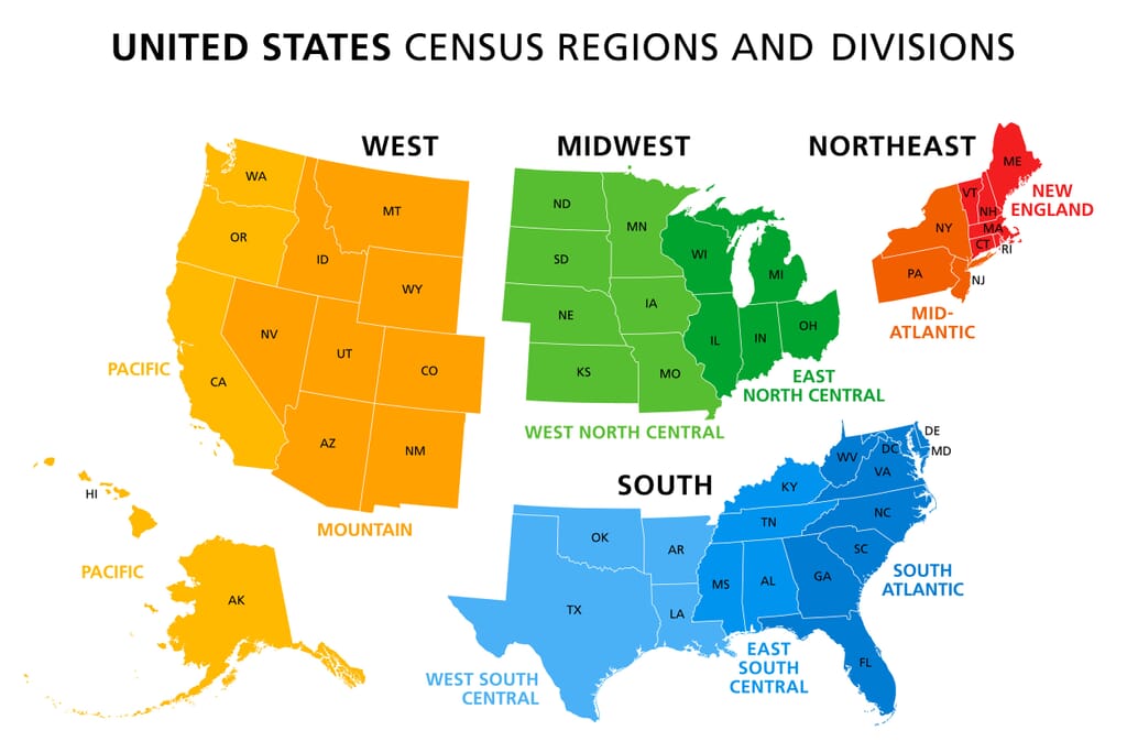
The Northeastern United States is one of the US regions with the longest national history. European settlers landed in this area in the 17th century, although some parts of the region have been inhabited for 12,000 years by indigenous peoples.
Ivy League schools, seafood, impressive fall foliage, and New York City are some things the nine states in this region are best known for.
Defining different regions in the United States can be difficult. Cultural, geographic, and historical elements all play a role in determining what region a state belongs to, and not everyone has the same answer. For this post, we stick with the Northeast Region as defined by the US Census Bureau:

Northeast Region States:
There are alternative definitions of the United States Northeast, especially when it comes to the southern border of the region. We’ll answer some frequently asked questions here in the next section.
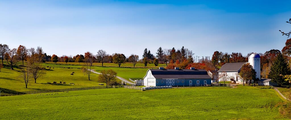
Connecticut is a relatively small state in the Northeastern United States, and the furthest south state of the New England area. It borders the Long Island Sound, an estuary of the Atlantic Ocean, to the south, as well as New York, Rhode Island, and Massachusetts.
The name of this state comes from the river that runs through it, the Connecticut River. This is the longest river in New England, and the spelling of the name is an anglicized version of the Mohegan-Pequot word for “long tidal river.”
There is evidence of humans inhabiting this region for 10,000 years, and various Native American populations lived in the region before Dutchmen arrived in the early 17th century. It became the fifth state of the USA in 1788.
Connecticut’s location on the Long Island Sound has provided it with an extensive maritime history. Seafood production, ship construction, and marine transport have been major contributors to Connecticut’s economy during its time as a state.
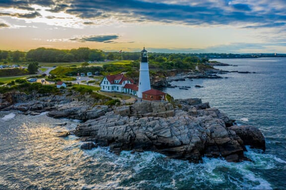
Maine is the furthest northeast state in the contiguous United States. It’s also the country’s most rural state, and it borders Canada, the Atlantic Ocean, and New Hampshire.
Geographically, Maine is known for its rocky Atlantic coastline as well as mountains, forests, and many waterways. About 80% of Maine is forested or unclaimed land, which makes it the state with the most forest cover in the nation.
Seafood cuisine, especially clams and lobsters, is an important part of the state’s cultural identity, as is the arts scene in its largest city, Portland.
Interestingly, there isn’t an agreed-upon explanation for the naming of this state. One theory is that it was named after the former province of Maine in France, and another is that it was a nautical reference to the mainland.
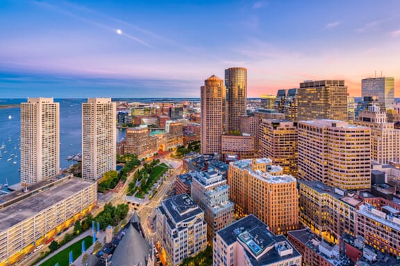
This is the most populous state of the New England region in the United States, and its capital city, Boston, is the populous city in the region.
Massachusetts is located in an area that was an early site of English colonization, and the area was inhabited by tribes of the Algonquian language family before their arrival. It was the sixth state to join the USA in 1788.
One of the things Massachusetts is most famous for is its world-renowned universities. MIT and Harvard are both located in the city of Cambridge, and each has a prestigious reputation. This is likely why the state’s population has been described as having the country’s highest average IQ.
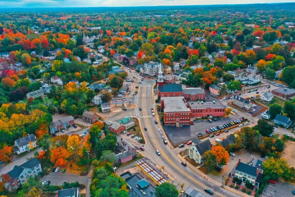
New Hampshire is a small state in the northeastern United States that borders Maine, Vermont, Massachusetts, Canada, and the Atlantic Ocean. It is the fifth-smallest state in the country.
This state was heavily involved in the American Revolutionary War, as alluded to in the state’s motto, “Live free or die.” It was one of the thirteen colonies that rebelled against British rule.
New Hampshire has the shortest ocean coastline of any state in the USA, and Hampton Beach is a popular destination for locals in the summer. Mountains, coastal forests, and inland wooded areas make up much of the state’s terrain.
This was the first state to adopt its own state constitution, and it was home to the first free, public library in 1833.
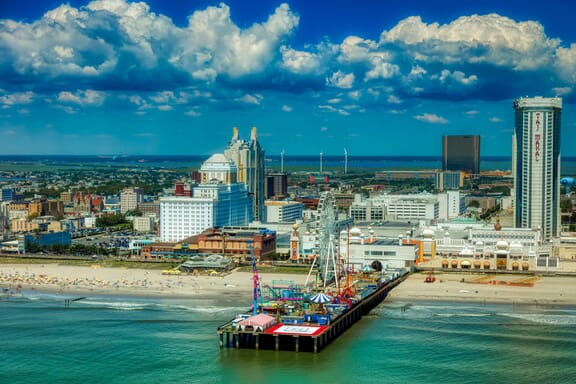
The area of New Jersey was inhabited for at least 2,800 years by Native Americans, and the Lenape people were the most prominent in the region when European settlers arrived in the 17th century.
The first European settlements were founded by the Dutch and Swedish, and New Jersey became the 3rd state to join the USA in 1787.
New Jersey has a significant Atlantic coastline, and its largest metropolitan area falls within Greater New York. Atlantic City, a resort town on the Jersey shore, is a major contributor to the state’s tourism economy.
There is a high level of affluence in New Jersey. It has the third-highest per capita income of any state, and it had the highest number of millionaires per capita in 2020. Nine of the state’s counties are in the top 100 wealthiest counties in the country.
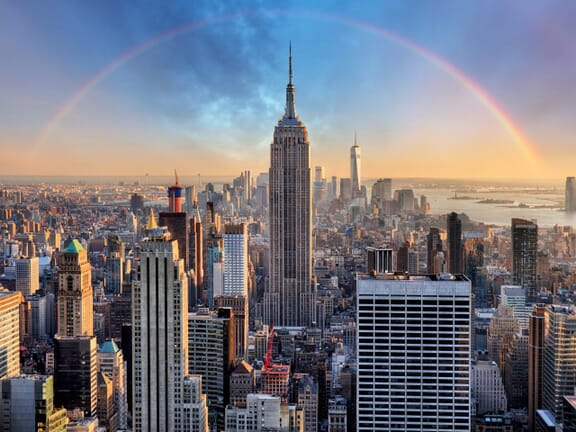
New York is one of the most world-famous states, largely because of New York City, the most populous city in the United States. The state shares a border with Canada, five other US states, and the Atlantic Ocean.
Approximately half of the state’s population lives in the New York City metropolitan area. The city has been known as the cultural, financial, and media capital of the world and is home to the United Nations headquarters.
The capital city of New York is Albany, which is located in the eastern part of the state, near the border with Massachusetts. It’s located on the banks of the Hudson River and was a major center for trade in the region in the 18th and 19th centuries.
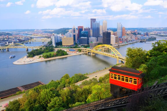
Originally one of the thirteen colonies that would rebel against British rule, Pennsylvania became the second state to join the United States in 1787. It is located in the northeastern USA, just south of New York.
Pennsylvania’s geography is widely varied; almost 60% of the state is forested, there are multiple mountain ranges that span the state, and it has more navigable rivers than any other state. It is the only state of the original thirteen colonies that does not have an Atlantic Ocean coastline.
Rural portions of southern Pennsylvania are widely known for their large Amish populations, and the city of Scranton, Pennsylvania was made famous by the popular sitcom, The Office.
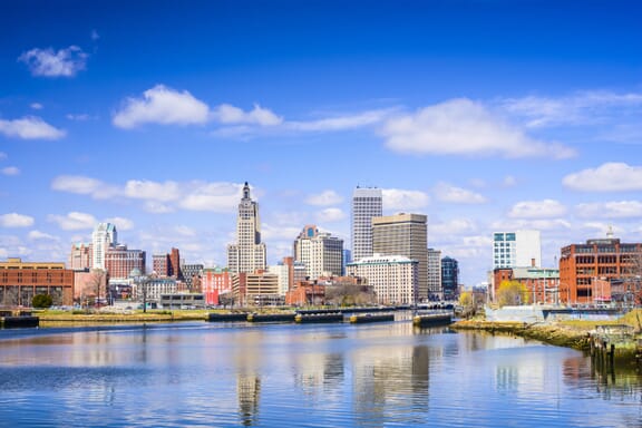
Rhode Island is the smallest state in the United States by area, and it borders Connecticut, Massachusetts, and the Atlantic Ocean. It’s also the second-most densely populated state after New Jersey.
The capital city of Rhode Island is Providence, which is also the state’s most populous city. It was founded in 1636, making it one of the oldest cities in the country.
The official nickname of Rhode Island is, “The Ocean State” because of its hundreds of miles of coastline and large bays. These water areas constitute about 14% of the state’s total area.
Rhode Island was the first of the colonies to end its allegiance to the British Crown, and it was the first to push for a Continental Congress. The state was the 13th to ratify the constitution, officially joining the USA in 1790. It had initially refused to ratify the constitution, instead favoring a weaker central government.
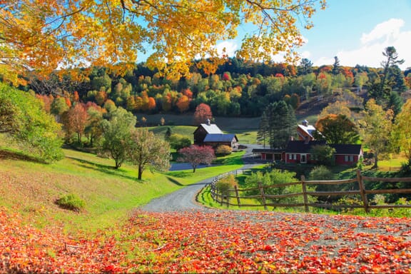
Vermont is a state in the northeastern United States that borders Canada, New York, New Hampshire, and Massachusetts. It has the second-smallest population of any US state, after Wyoming.
Indigenous peoples have inhabited this area for an impressive 12,000 years; during the 17th century, French colonists claimed the land here and then ceded its territory to Great Britain in 1763. Vermont later ratified the US Constitution in 1791, becoming the 14th US State.
Today, Vermont is known for beautiful forests, green mountains, hiking trails, and for being the country’s top maple syrup producer. Vermont was also one of the first states to abolish slavery.
Related Map: Southeast US Map
The Mason-Dixon Line is a demarcation line surveyed by English astronomers Charles Mason and Jeremiah Dixon between 1763 and 1767. It was used to resolve a border dispute between the states of Pennsylvania, Delaware, Maryland, and Virginia.
The line is important in the context of US regions because it has historically been used to differentiate the North from the South, especially the east-west portion of the line separating Pennsylvania from Maryland. It became known informally as the border between the Southern slave states and the Northern free states.
The line is still used to figuratively separate the Northeast United States from the Southern United States culturally and politically.
According to the US Census Bureau, Maryland is part of the South. The fact that it is just south of the Mason-Dixon Line is a major reason to consider the state as being part of the South, as is its historically high slave population.
Some people, however, see large cultural and political differences between modern-day Maryland and other Southern states. The state usually votes for the Democrat party, for example.
Maryland was a Union state during the Civil War. However, its status as a border state meant that large rural populations were sympathetic to the Confederacy. Although Maryland never seceded from the Union, it remained a slave-holding state throughout the Civil War.
Maryland was a Union state during the Civil War. However, its status as a border state meant that large rural populations were sympathetic to the Confederacy. Although Maryland never seceded from the Union, it remained a slave-holding state throughout the Civil War.
The northern border of the Southern United States begins in the east at the Mason-Dixon Line under Pennsylvania. This makes Maryland, Delaware, and West Virginia the northernmost states in the South.
The northern border of this region extends across the tops of Kentucky, Arkansas, and Oklahoma to the west.
New England is in the northeastern corner of the United States. It is composed of six states: Connecticut, Maine, Massachusetts, New Hampshire, Rhode Island, and Vermont. The region was named by English explorer John Smith in 1616.
The map below details the boundaries of the six US states that belong to the New England region. It also shows the capital city of each state.
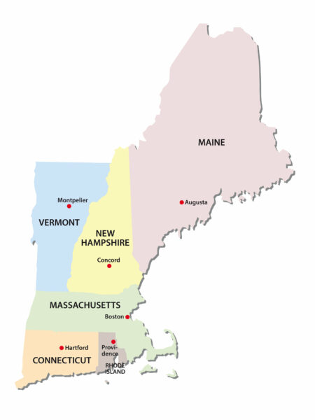
New England is one of the smallest geographic regions in the United States, but is also one of the oldest and one that played crucial roles in the development of the country. It was the cultural and economic center of the USA from the 17th to the 18th centuries.
The earliest European settlers arrived in this region seeking religious freedom. None of the New England colonies have great soil for farming, but they do feature flat coastlines that functioned as important harbors during the early days of the country.
It is in New England that the Ivy League schools are located, including Harvard, the country’s first university. The region maintains a strong cultural identity until now and is well-known for its cuisine.
The Northeastern US is part of the larger US East Coast region. The states in this region are those that are in proximity to the Atlantic Ocean or have some Atlantic coastline.
The northern and southern parts of the East Coast are often separated for the cultural, historical, and political differences between them.
The map below shows the states in this region, the borders between them, and the capital city of each state.
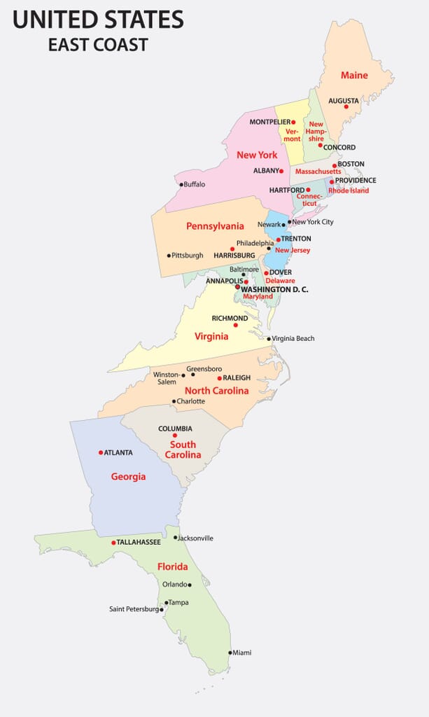 showing the east coast of the United States with states and major cities labeled. States include Maine, Vermont, New Hampshire, Massachusetts, Rhode Island, Connecticut, New York, New Jersey, Pennsylvania, Delaware, Maryland, Virginia, North Carolina, South Carolina, Georgia, and Florida. The map is color-coded by state and has a title at the top that reads "United States East Coast."" width="613" height="1024" />